


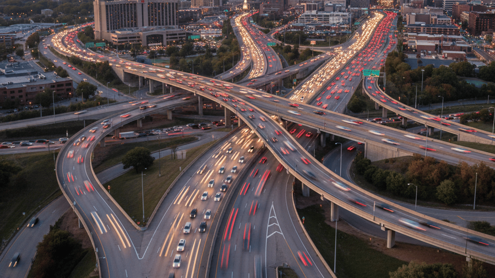
If you are thinking about moving to Nashville, you’re probably picturing live music and neon signs, but the practical side of life here revolves around how you get from Point A to Point B. Nashville is a true transportation hub. We sit right where three major interstates—I-40, I-65, and I-24—come together.
While the city has a reputation for being car-dependent, the landscape is shifting. We have a growing public transit system and pockets of very walkable neighborhoods. However, your daily commute experience will depend heavily on where you choose to live versus where you work. Let's break down exactly what to expect on the roads and rails of Music City.
Do You Need a Car to Live in Nashville?
The most common question I get from new residents is whether they really need a vehicle. To be honest with you, for the vast majority of people living here, the answer is yes. Nashville is spread out, and our suburbs stretch deep into the surrounding counties.
Roughly 80% of residents drive to work, and because our transit system relies on a "hub-and-spoke" model, running cross-town errands often requires a car. If you live in a suburb and work in another suburb, public transit usually requires you to go all the way downtown and back out again, which isn't practical for daily life.
That said, living car-free is definitely possible if you are strategic about your location. If you settle in high-density areas like Downtown, The Gulch, or the neighborhoods surrounding Vanderbilt University, you can easily get by on foot or with rideshares. But if you are looking at more residential areas, you will likely want your own set of wheels.
Driving in Nashville: Traffic Patterns and Major Highways
Since most of us drive, you need to get familiar with the "Big Three" interstates. Nashville is bisected by I-40 (running East-West), I-65 (North-South), and I-24 (which cuts through diagonally). Where these roads merge near downtown can be a bit intimidating for newcomers, especially the splits where lanes shift quickly.
Beyond the main arteries, we rely on two loops to manage flow. I-440 is the "inner loop" that lets you bypass the downtown core if you are moving between the southern and western parts of the city. Then there is Briley Parkway (SR 155), which serves as the "outer loop" and is your main connector to the Opryland area and the airport.
Traffic is a reality here, just like in any growing city. You can expect heavy congestion during the standard rush hours of 7:00 to 9:00 AM and 3:00 to 6:00 PM. Locals will tell you that I-24, particularly the stretch toward Mulfreesboro, is notoriously congested. The average commute generally hovers around 25 to 30 minutes, but if you are caught in the thick of rush hour or a Titans game day, you should plan for that time to double.
Navigating Public Transportation: WeGo Public Transit
If you want to skip the driving, WeGo Public Transit is our bus system. It has improved significantly in recent years, making it a viable option for many, especially if you work downtown. The heart of the system is WeGo Central at 400 Dr. Martin L. King Jr. Blvd. Since most routes connect here, it’s the primary transfer point for the city.
Frequency varies depending on where you are. On major corridors like Murfreesboro Pike, Gallatin Pike, and West End, you will see buses running every 15 to 20 minutes. If you are on a smaller local route, those buses might only come once every 40 minutes to an hour, so checking the schedule is essential.
Payment is modern and easy. While you can still use exact cash (the fare is around $2.00 per ride), most regular riders use "QuickTicket." This is available as a smartphone app or a reloadable card. It’s convenient because it automatically caps your daily spending—once you hit the daily max, the rest of your rides that day are free.
Commuting from the East: The WeGo Star
For those looking at living in Mt. Juliet or Lebanon, there is a unique option called the WeGo Star. This is a heavy rail commuter train that runs from the eastern suburbs straight into Nashville Riverfront Station downtown.
It is important to understand what the Star is and isn't. It is not a subway system running 24/7. It is specifically designed for the workday commute, running six round trips on weekdays only. It operates during morning and afternoon peak times, making it perfect for 9-to-5 professionals.
The train stops at Martha, Mt. Juliet, Hermitage, and Donelson before arriving downtown. If you fit the schedule, it’s a fantastic, stress-free way to bypass the traffic on I-40, but you won't be able to use it for a late Saturday night dinner in the city.
Walkability, Biking, and Scooters
Nashville isn't known as a pedestrian city overall, but we have specific neighborhoods that are very walkable. Areas like Downtown, The Gulch, Germantown, 12 South, and Five Points in East Nashville are incredibly pedestrian-friendly. In these districts, you can easily walk to coffee shops, grocery stores, and restaurants.
For cyclists and recreational walkers, the "Greenways for Nashville" network is a massive perk. These are paved trails connecting parks and neighborhoods, such as the Shelby Bottoms or Richland Creek greenways. Some residents even use them to commute by bike, avoiding road traffic entirely.
If you are downtown and need to move a few blocks quickly, you will see electric scooters (like Bird and Lime) everywhere. Just remember the local rules: you must ride them on the street or in bike lanes, never on the sidewalks. Nashville B-Cycle also offers bike-share stations if you prefer pedaling over scooting.
Parking in Nashville: What to Expect
If you drive downtown, you have to pay for parking. Free street parking in the central business district is rare and hard to find. Most parking is handled through metered spots, surface lots, or garages.
Metered parking is strictly enforced, so always check the signs. Sometimes they are free after 6:00 PM or on Sundays, but this varies by street. The cost for meters usually runs about $2.25 per hour. For garages and lots, prices can vary wildly. A standard day might cost you $15 to $20, but during special events like a concert or a big game, those rates can spike to $40 or more.
To make life easier, most locals use parking apps like ParkMobile or SpotHero. These let you pay from your phone or even book a garage spot in advance so you aren't circling the block.
Airport Access and Rideshare Services
Getting out of town is generally easy. Nashville International Airport (BNA) is located just 8 to 10 miles east of downtown, making it a quick trip for most residents.
If you don't want to drive and park at the airport, rideshare services like Uber and Lyft are reliable and abundant. For a cheaper option, the WeGo Route 18 bus runs directly between BNA and the downtown central station.
There is also a regulated flat-rate zone for taxis. Trips between the airport, the downtown area, and the Opryland hotel area have a set fee (usually around $25–$30, though you should confirm the current rate before hopping in). This prevents any surprises on the meter if traffic is heavy.
Frequently Asked Questions
Is public transportation free in Nashville?
No, public transportation is not free. The standard bus fare is generally $2.00 per ride. However, using the QuickTicket system provides daily cost caps, making it very affordable for frequent riders.
Does Nashville have a subway system?
No, Nashville does not have a subway or underground metro system. We have the WeGo Star, which is a commuter train, but it runs above ground and services only the eastern corridor during weekday rush hours.
What is the best way to get around Nashville without a car?
The best strategy is to live in a dense, walkable neighborhood like the Gulch or Germantown and rely on rideshare services for longer trips. You can also combine walking with the WeGo bus system if your workplace is on a major route.
Is it difficult to drive in Nashville?
It can be challenging for new residents due to congestion and complex interstate merges. The traffic on I-24 and the splits where I-40 and I-65 meet require alert driving, but once you learn your specific route, it becomes much more manageable.